On 2021-7-18, I hiked a route starting and ending at the turning circle at the end of the residential road known as Panthorn Trail in Southington. There were temporary "No Parking" signs on the northeast side of the turning circle but they did not seem to apply to the whole circle. I'll put in two screenshots I made with screenshots of the Connecticut Forest and Park Association online map. The numbers are location numbers. All the trails I walked on are cared for by the Connecticut Forest and Park Association. CFPA likes to know about any trail-maintenance issues, so I took pictures of fallen trees (blow-downs) on the trails, of some overgrown spots and of places where crossing Cussgutter Brook was a challenge. I took pictures of other views that interested me.
The southern part of my route.
The northern part of my route.
1. A blow-down on the blue-red trail that takes hikers from Panthorn Trail to the blue-yellow trail.
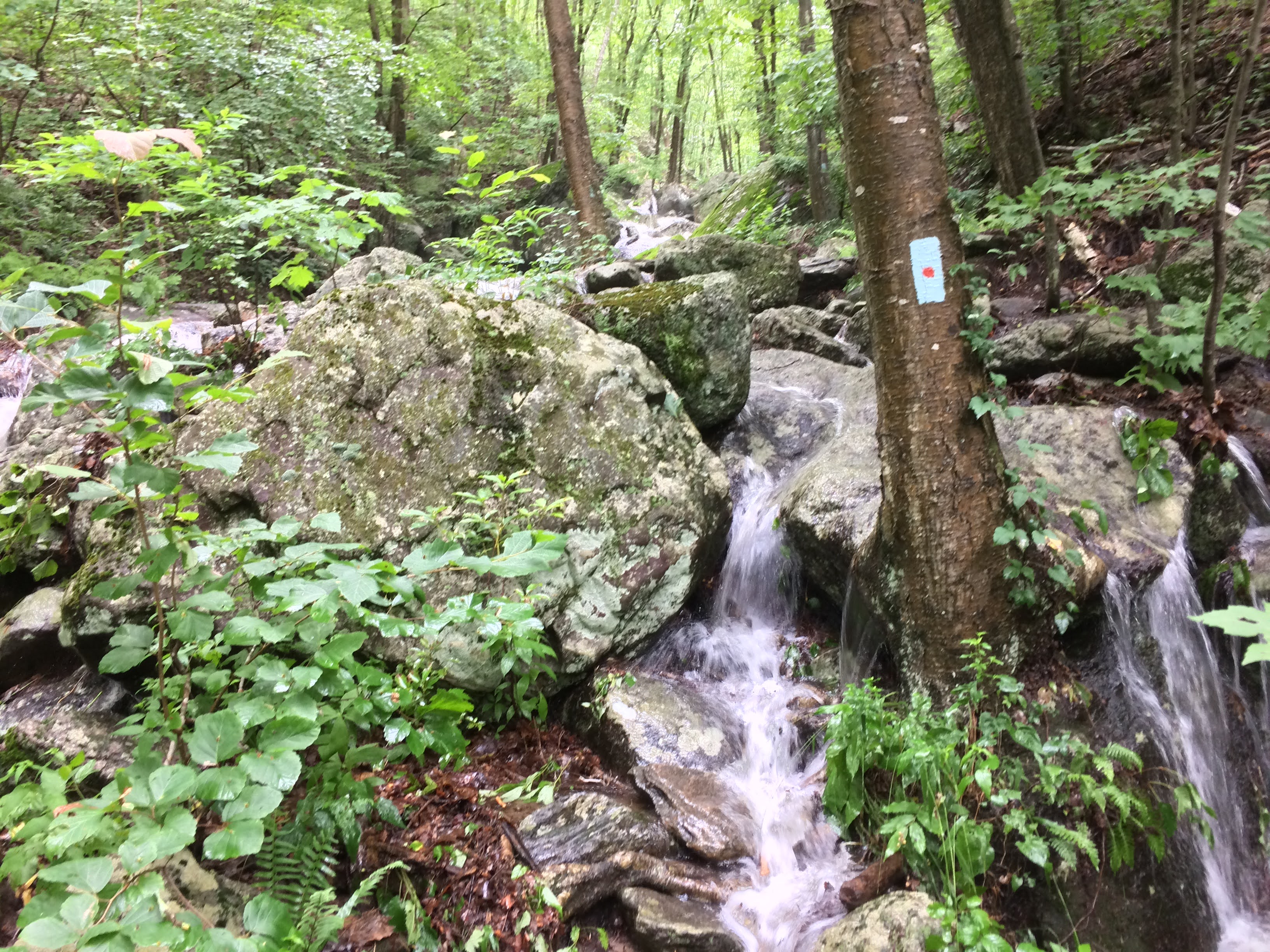
2. It had rained intensely the night before my hike. This waterfall (not on a trail) is not usually there.
3. A blowdown near where the blue-red trail meets the blue-yellow trail.
4. A blow-down.
5. A blow-down.
6. A blow-down.
7. A blow-down. Off-road motorcycles may use most sections of the CFPA trails. I talked to two men with off-road motorcycles at a viewpoint near 7. They had ridden northerly from somewhere near the Mount Southington ski area. I saw then ride off on the blue-yellow trail and then turn onto one of the many unblazed trails. I think, if off-road motorized vehicles are to be eliminated from the area, the landowners would have to unite and prevail upon the local authorities to arrest operators of motorized vehicles. Signs saying that off-road vehicles are prohibited and where to call if an off-road vehicle is spotted would have to be posted.
8. A blow-down.
9. A scene on the blue-yellow trail. Parts of the blue-yellow trail and the blue-purple trail wind on and off wide thoroughfares used by ATVs.
10. Where I crossed a raging Cussgutter Brook, which is not where the blue-yellow trail crosses Cussgutter Brook. I did not have to put my boots into water more than about two inches deep. Tunxis trails cross Cussgutter Brook in four places. The western-most crossing has a beautiful bridge built, with help from Wayne Fogg and others, by Tom Burkholder.
11. A blow-down.
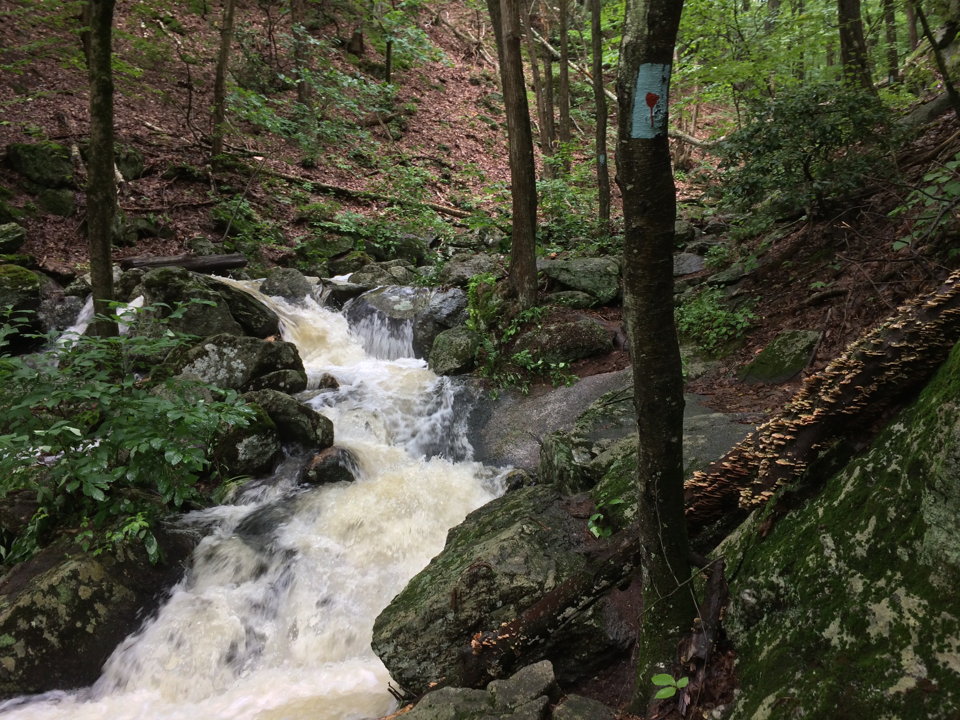
12. Cussgutter Brook in full flow.
13. Water flowing on the blue-red trail. There was lots of water on various sections of the Tunxis trails, but I think that could not be prevented without radically changing the trails.
14. Another scene on Cussgutter Brook.
15. Cussgutter Brook.
16. A blow-down.
17. Normally, there are exposed flat rocks here where the blue-red trail crosses Cussgutter Brook.
18. I crawled across this bridge.
19. A blow-down.
20. A blow-down.
21. A section of trail that was not four feet wide.
22. Another section of trail that was not four feet wide.
23. How many plant species can you see that were encroaching on the trail here?
24. A view of West Peak in Meriden from Julian's Rock. Veteran trail maintainer Dan Casey suggested that "Julian" was an owner of the Lake Compounce amusement park which owns much of the land used by Tunxis trails in this area.
25. A blow-down.
26. A blow-down which still had green leaves on it.
27. A blow-down.
28. One of plants that is common along Tunxis trails in this area is Bear Oak, Quercus ilicifolia. The leaves vary in shape, but always have bristles at the ends of their lobes.
28. Bear oak acorns.
28. Another bear oak leaf shape.
28. The entire bear oak shrub.
29. A blow-down.
30. A blow-down.
31. Two blow-downs that have formed steps by blocking debris that has flowed downhill.
David Reik


Comments
Post a Comment