2021-5-26, Simsbury Town Forest to Onion Mountain, Canton, CT
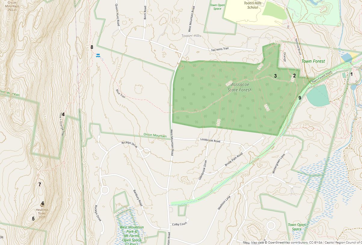
On 2021-5-26, I hiked from Simsbury Town Forest to Onion Mountain in Canton, and back. Here's a link to an interactive map that has location numbers that I will refer to:https://arcg.is/1e9HKH . Here's a static screenshot of the interactive map.
1. A map of Simsbury Town Forest was posted near where I parked. I only hiked a small part of Simsbury Town Forest before I headed westerly into Massacoe State Forest and further westerly into Canton and up onto Onion Mountain.
2. In Massacoe State Forest, the trails were narrow with blowdowns, but I managed to follow trails westerly towards Onion Mountain. At 2, I saw a box turtle.
2.
3. Some say that pitch pines are rare in Connecticut. I don't think so.
4. As I started to climb Onion Mountain, I noticed this American Cancer-Root, Conopholis americana, plant. As I proceeded southerly, I saw many more of these plants. These plants have flowers but no chlorophyll. More information: https://www.fs.fed.us/wildflowers/plant-of-the-week/conopholis_americana.shtml
5. This was near the highest point I got to on Onion Mountain, which actually is a ridge. I followed a trail blazed with both blue and orange nail-on blazes to the the trail's end and kept going southerly another 0.12 of a mile to a highpoint.
6. There were many pignut hickory trees on top of the ridge.
6. A view through the trees to the southeast.
6. Heublein Tower was visible.
7. The southern-most pair of blazes was here.
8. The Blue Trail had blazes of various shapes including triangles and squares.
9. On my way back, where a very dim trail met the gravel bike path, I noticed this sign. I went to www.friendsofmassacoe.org and found that the timber-cutting project had been abandoned by DEEP. I noticed that about a third of an acre of trees had been cut where the blue trail meets West Mountain Road.
David Reik


Comments
Post a Comment