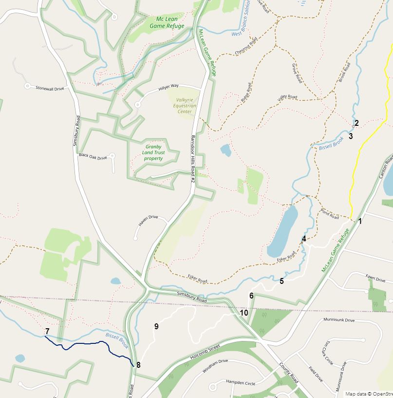
On 2021-1-31, I went back to a section of McLean Game Refuge in hopes of recording some blaze and name changes I'd noticed on an earlier trip. I made an interactive map with location numbers. Here's a link to my interactive map: https://arcg.is/0CCX4P0 . I put in a contour-lines layer which you can turn on and off. There were many short, steep sections on the trails I used on 2021-1-31. Here's a static screenshot of my interactive map.
1. Where I parked, near (but not in front of) a gate where Pond Road meets Canton Road.
2. This very narrow bridge across Bissell Brook is one that I have crossed, but I think I used hiking poles which I stuck into the sandy brook bottom. I stayed on the eastern side of Bissell Brook on 2021-1-31.
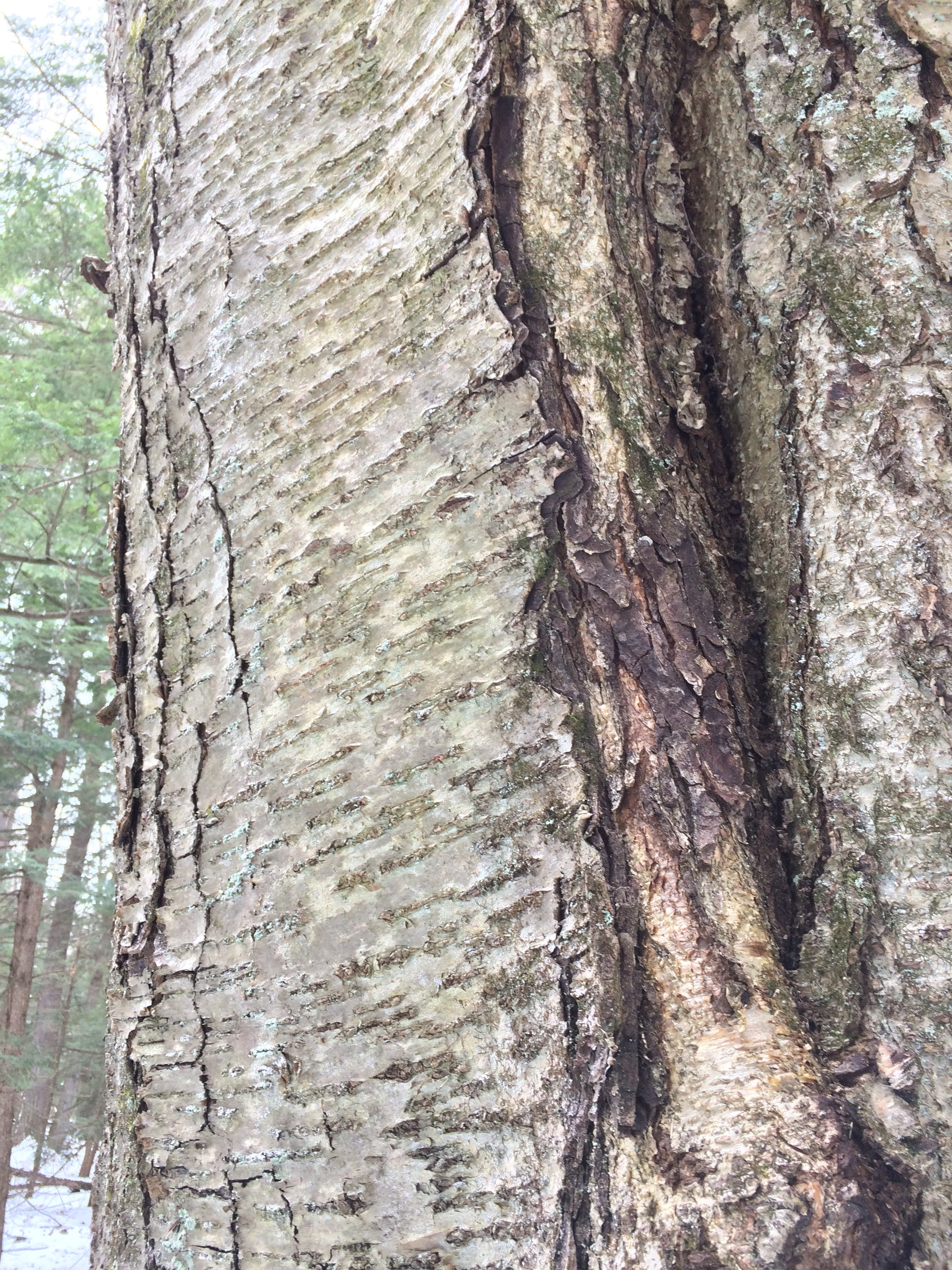
3. This tree is off-trail. Connor Hogan, the director of McLean Game Refuge, says it's a yellow birch. Here's a link to Connor Hogan's post on the Connecticut's Notable Trees website:
http://oak.conncoll.edu:8080/notabletrees/ViewTreeData.jsp?selected=226358
3. I would not know how to tell this tree from a large black birch. I associated yellow birches with tight vertical coils of bark which I did not see on this tree.
4. Here, where Esker Road crosses Bissell Brook, the brook was frozen.
5. A view of Bissell Brook through the abundant hemlock trees from the white-blazed section of Sandy Trail. Sandy Trail is now divided between a yellow-blazed section (open to horses part of the year) and a white-blazed section which is always closed to horses.
6. One of the many spots along McLean Game Refuge trails where I saw evidence of vigorous recent trail-clearing work.
7. This log across Bissell Brook seems to have been deliberately felled to create a sort of bridge. The stream is about a foot deep here. I have never crossed on the log. I know people who would casually work across the log. South Trail continues on the other side of Bissell Brook, but, last time I was there, without blazes. East of Bissell Brook, the section of South Trail west of Barndoor Hills Road has dark blue blazes. The section of South Trail east of Barndoor Hills Road has white blazes.
8. On my way back, I took a picture of this sign on the east side of Barndoor Hills Road, one of several similar signs I encountered on my hike. The arrow was pointing northeasterly. I don't think this sign was trying to communicate that one would find South Trail 0.9 miles to the northeast, but that the sign was on South Trail, and that South trail continued for 0.9 miles starting in a northeasterly direction.
9. This is a turn blaze on the now-white-blazed section of South Trail. McLean Game Refuge uses horizontal rectangles as blazes, rather than the Connecticut Forest and Park Association vertical dollar-bill-sized blazes. McLean turn blazes look very much like CFPA end-of-trail blazes. McLean turn blazes do not indicate the direction of the turn, unlike CFPA turn blazes.
10. My guess is that there used to be a sign here that said, "Sandy Trail 2.5 mi" with an arrow pointing easterly. The sign was also missing on the western side of County Road. That sign should have said, "South Trail 1.5 mi" with an arrow pointing westerly.
1. Next to my car was one of many pitch pines I saw on my hike. Note the bark divided into roughly rectangular plates, and the needles in clumps of three. Pitch pines like sandy soil.
David Reik


Comments
Post a Comment