2020-6-28, Rogers Orchard - Crescent Lake Route, Southington, CT
On 2020-6-28, I hiked a 7.1-mile route starting and finishing at the parking lot across the street from the Rogers Orchard store. I made an interactive map of my route. You can export my .gpx track and load the track into your GPS device if you want to follow my route. I'll put in the approximate mile points for each picture. On the interactive map, you can see the mileage for any point along the route. Here's the link to the interactive map: https://ridewithgps.com/routes/33175748?beta=false . Below is a screenshot of the interactive map. If you want to do a route that doesn't require trespassing, I'd suggest staying on the blazed trails.

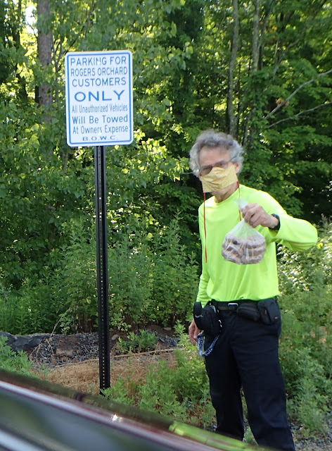
Mile 0,0. I bought some doughnuts at the Rogers Orchard store. An employee told me that my car would be towed if the car was in the lot after 4:00 P.M., when the store closes.
Mile 0.13. Common Toadflax, Linaria vulgaris, an invasive plant that was imported as a garden plant.

Mile 1.04. This is on a trail built by mountain bikers. This land is apparently also owned by the City of New Britain which doesn't want people here. Trees had been intentionally felled to block mountain bike trails, and a bridge built by mountain bikers had been cut up. The Metacomet must have permission to go through the New Britain-owned land, but the mountain bike trails exist without permission. Perhaps a political movement could be organized to get permission for expanded recreational use so this resource is not wasted.

Mile 1.26. A grotto.

Mile 1.48. Some of the illegal mountain bike trails use the same route that the Metacomet Trail used to use. How old is this blue blaze?

Mile 1.79. Mr. Bill's Cave. Mr. Bill was a sadist featured in recurring skits on Saturday Night Live in the 1970s. The white marks that aren't letters are a material put on the rock by people doing "bouldering," a form of rock climbing that is performed on small rock formations or artificial rock walls without the use of ropes or harnesses.

Mile 1.91. I saw many trees with these blue paint splotches, one about five feet high, and the other near ground level. These indicate that there is a plan to cut the marked tree. I wouldn't think that a tree as small as the one pictured would be valuable timber, so why is it being cut? Just to thin the forest?

Mile 2.54. Someone has put on OpenStreetMap.org the words, "Old Cabin" at the location of this chimney. I date the chimney from 1947. Maybe there was some sort of hunting cabin here. My guess is that the chimney was always for outdoor use and was never part of any shelter.

Mile 2.58. You can see Lake Compounce rides, and the Otis test tower.

Mile 3.40 Is this supposed to be a depiction of Groucho Marx?

Mile 3.73. Now I'm going onto the land owned by Tilcon Connecticut, the company that owns the huge traprock quarry.

Mile 3.78. An overgrown mountain bike path.

Mile 3.85. A view of the quarry.

Mile 4.25. A rock overhang. There was another Tilcon "No Trespassing" sign near here.

Mile 4.69. The trail goes right through the cleft rock.

Mile 5.21. The bark with the roughly 5" by 1" plates and the three needles in a clump shows that this is a pitch pine tree.

Mile 5.94. Boating and fishing are allowed on Crescent Lake, but not swimming. The parking lot was not quite full

Mile 5.99. It looks like someone mowed a path through the mugwort on this mountain bike path.

Mile 6.53. This must be back on New Britain-owned land. This tree (and many others) had been intentionally felled to block the mountain bike path.

Mile 6.53.

Mile 6.61. Two needles in a clump, and the reddish, relatively smooth bark, shows that this a red pine tree. Red pines were planted by water companies around 1960. Many, but not all, have died.

Mile 6.68. The sign doesn't mention hiking.

Mile 6.81. I think this is a decaying plaster figure of some sort.

Mile 6.84. A sassafras tree. Note the horizontal breaks in the criss-cross ridges.

Mile 6.91. New Britain doesn't want you parking near the Metacomet trailhead. But since we're in Southington, who would do the towing?


Mile 0.0. Apparently, the lot is not owned by Rogers Orchard, but by the City of New Britain. The "B.O.W.C." on the sign refers to the New Britain Board of Water Commissioners.


David Reik


Comments
Post a Comment