Posts

Showing posts from June, 2020

2020-6-28, Rogers Orchard - Crescent Lake Route, Southington, CT

Image
On 2020-6-28, I hiked a 7.1-mile route starting and finishing at the parking lot across the street from the Rogers Orchard store.  I made an interactive map of my route.  You can export my .gpx track and load the track into your GPS device if you want to follow my route.  I'll put in the approximate mile points for each picture.  On the interactive map, you can see the mileage for any point along the route.  Here's the link to the interactive map:  https://ridewithgps.com/routes/33175748?beta=false  .  Below is a screenshot of the interactive map.  If you want to do a route that doesn't require trespassing, I'd suggest staying on the blazed trails. Mile 0.0.  Apparently, the lot is not owned by Rogers Orchard, but by the City of New Britain.  The "B.O.W.C." on the sign refers to the New Britain Board of Water Commissioners.   Mile 0,0.  I bought some doughnuts at the Rogers Orchard store.  An employee told me that my car would be towed if the car was in the lo

2020-6-26, Ayers Gap Preserve, Franklin, CT

Image
On 2020-6-26, I explored Ayers Gap Preserve in Franklin, CT.  The preserve is owned by The Nature Conservancy.  Below is a link to an interactive map showing my route.  I put in location numbers to show where the pictures below were taken. http://arcg.is/1nOv9W I'll put in a static screenshot of the interactive map. 1.  This was near where I parked in a paved pull-off on the northern side of CT-207.  The top line of the sign should read, "Bailey's Ravine." 1.  There were some white blazes on this trail that went up steeply from the parking area and looped around the outside of the preserve. 2.  I took this picture because you can see poison ivy growing next to another plant which also has three leaflets.  Poison ivy is the plant that does not have saw-tooth leaflet edges. 3.  Near the northern end of the preserve, there was a cascade with the remains of a dam at the top of the cascade. 4  Note the curved cliffs. 4. 4. 5.  A view of the ravine. 5.  One of the many casc

2020-6-27, Swan Preserve, Canton, CT

Image
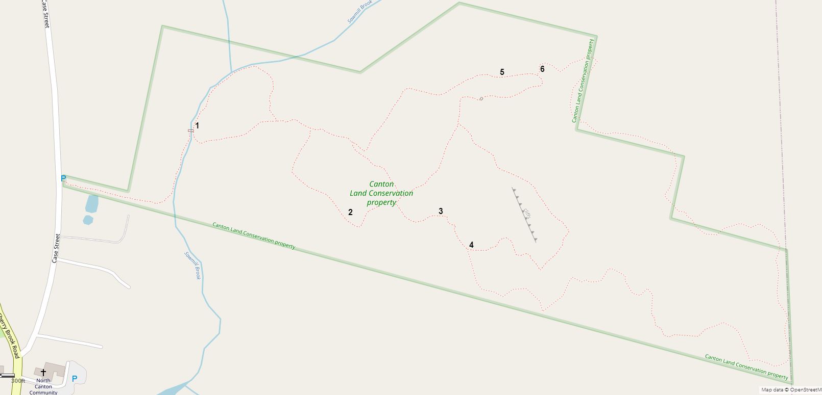
On 2020-6-27, I hiked all the trails in the Canton Land Conservation Trust Swan Preserve on Case Street.  I made an interactive map showing my route in pink.  I put in numbers showing where the pictures below were taken.  Here is a screenshot of the map: On the interactive map, you can turn on and off various layers including aerial imagery ("Ortho"), LIDAR ("Hillshade"), contour lines, my 2020-6-27 GPS track, and Waypoints.  Below is a link to the map. http://arcg.is/0SSHKe0 1.  This picture was taken on 2013-3-15. 2.  From 2020-6-27. 3.  From 2020-3-15. 4.  Ted Cowles was a long-time active member of Canton Land Conservation Trust.  He died in 2020 from COVID-19.  Land Trust people created a new trail in his memory.  This is the sign at the southern end of the U-shaped trail. 5.  Another picture from 2013-3-15.  There are several rock piles like this in Swan Preserve.  I think they are just places that farmers put rocks they were clearing from fields. 6.  The nort